PORTFOLIO
Theresa Monari
Personal Project
GIS
Remote Sensing
Siaya County is situated in the former Nyanza Province in western Kenya. The county shares a water surface area with Lake Victoria, the third-largest freshwater lake in the world. This project aims to analyze and map the Land Use and Land Cover (LULC) change of Siaya county from 2015 to January 2025 using ISO cluster Unsupervised classification method. The analysis utilizes ESRI’s ArcGIS Pro software to classify land cover types, such as built-up areas, vegetational land, and water, as of 2025. The results will support sustainable land management, environmental management, and urban planning. In addition, the results can be used to asses the impact of climate change and employ methods to curb the adverse impacts in aim to achieve environmental sustainability.
The 2015 Landsat-8 data from USGS Erath Explorer website was imported into ArcGIS Pro software, where I used the Band Composite tool to combine the 11 bands.
I extracted data for the study area (Siaya County) using the extract by mask tool
Using different band compinations for instance, 4-3-2 for natural color, 5-4-3 for Color Infrared (vegetation), and 7-6-4 for False Color (Urban), I interacted with the data to have a quick knowledge.
Unsupervised Classification: The ISO Cluster Unsupervised Classification tool was used to carry the analysis with the number of classes set to 4.
With appopirate identification using the Landsat-8 data and the world imagery basemap, I labelled the different feature classes with corresponding symbology as well.
In the Arc Toolbox, using the Raster to Polygon Conversion tool, I converted the raster layer to polygon, noted the feature classes and their representations.
I created new fields in the attribute table, one for Area and another for Percentage Area. Using the calculate geometry tool I calculated the areas and used the raster calculator to get the Percentage areas.
I repeated the same procedure for Landsat-8 2025 dataset.
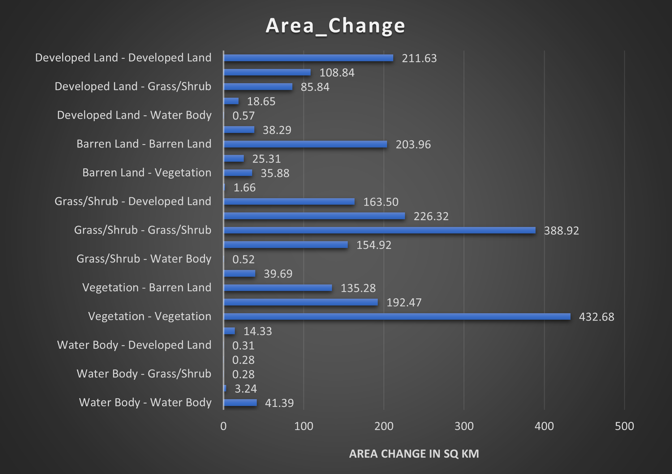
Change between 2015 and 2025 was determined using the intersect tool.
The data in the attribute tool was exported to the Microsoft Excel and visualized in a graphical form to see the area change.
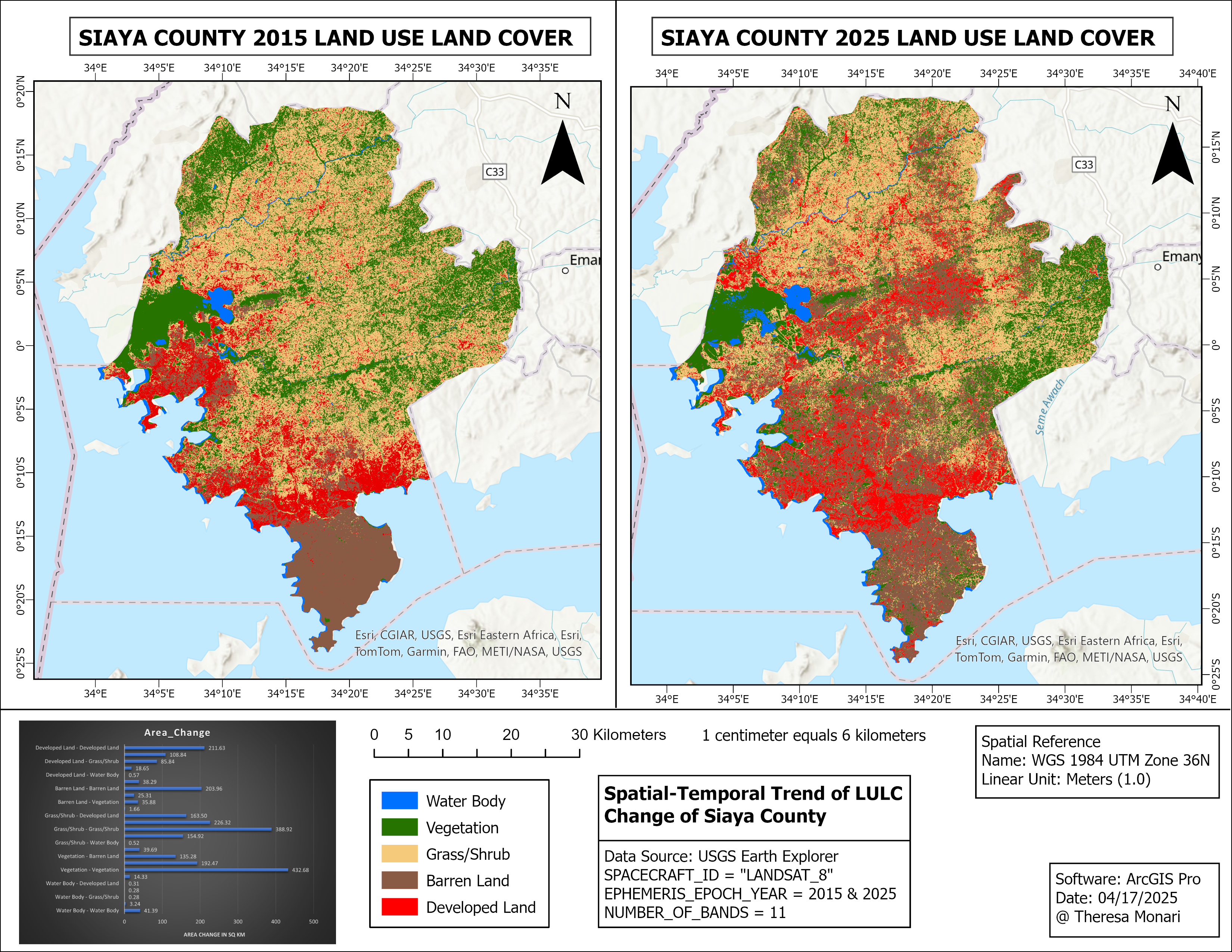
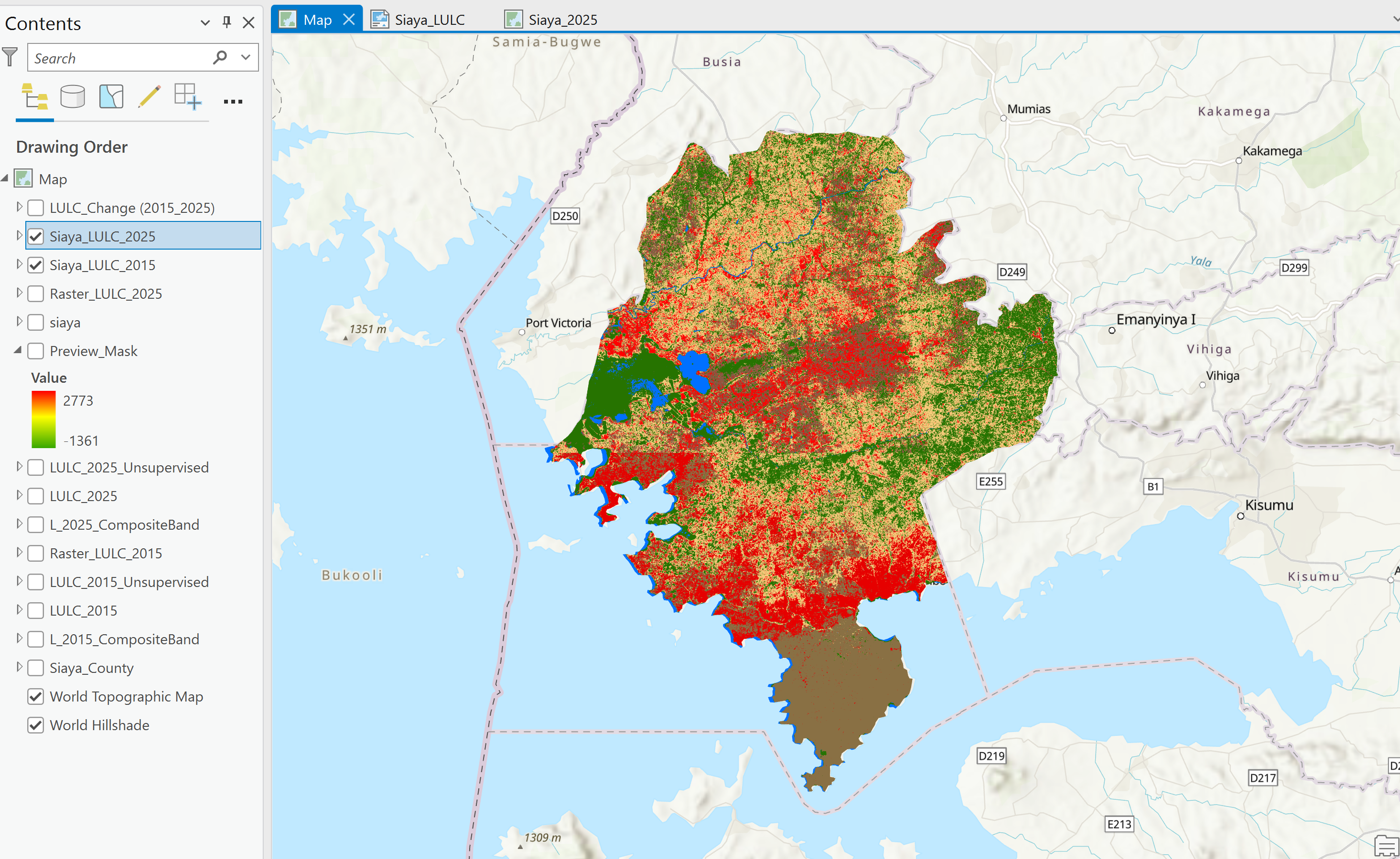
The 2025 Land Use Land Cover Analysis is overlayed on top of the 2015 in the swipe view
This project will provide the Kenya national government, Siaya county government, NGOs, and other stakeholders with actionable insights for:
By leveraging ArcGIS Pro's ISO Cluster Unsupervised Classification, this change detection project showcases a comprehensive analysis of Siaya County's land dynamics. The results will help policymakers, stakeholders, and researchers make informed decisions for sustainable development.
Theresa Nyatichi Monari
Email: nyatichitheresa@gmail.com
Please feel free to contact me. I look forward to hearing from you!