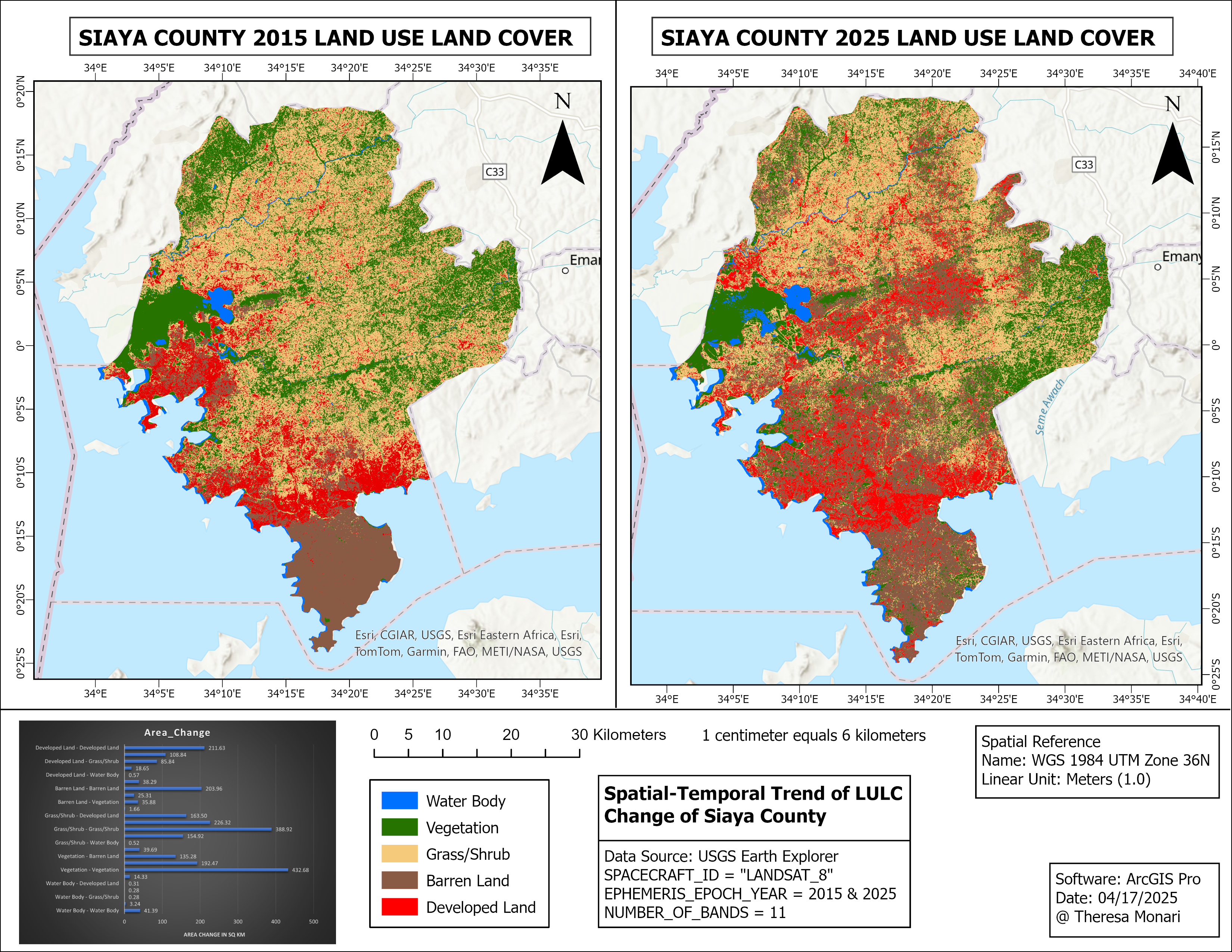
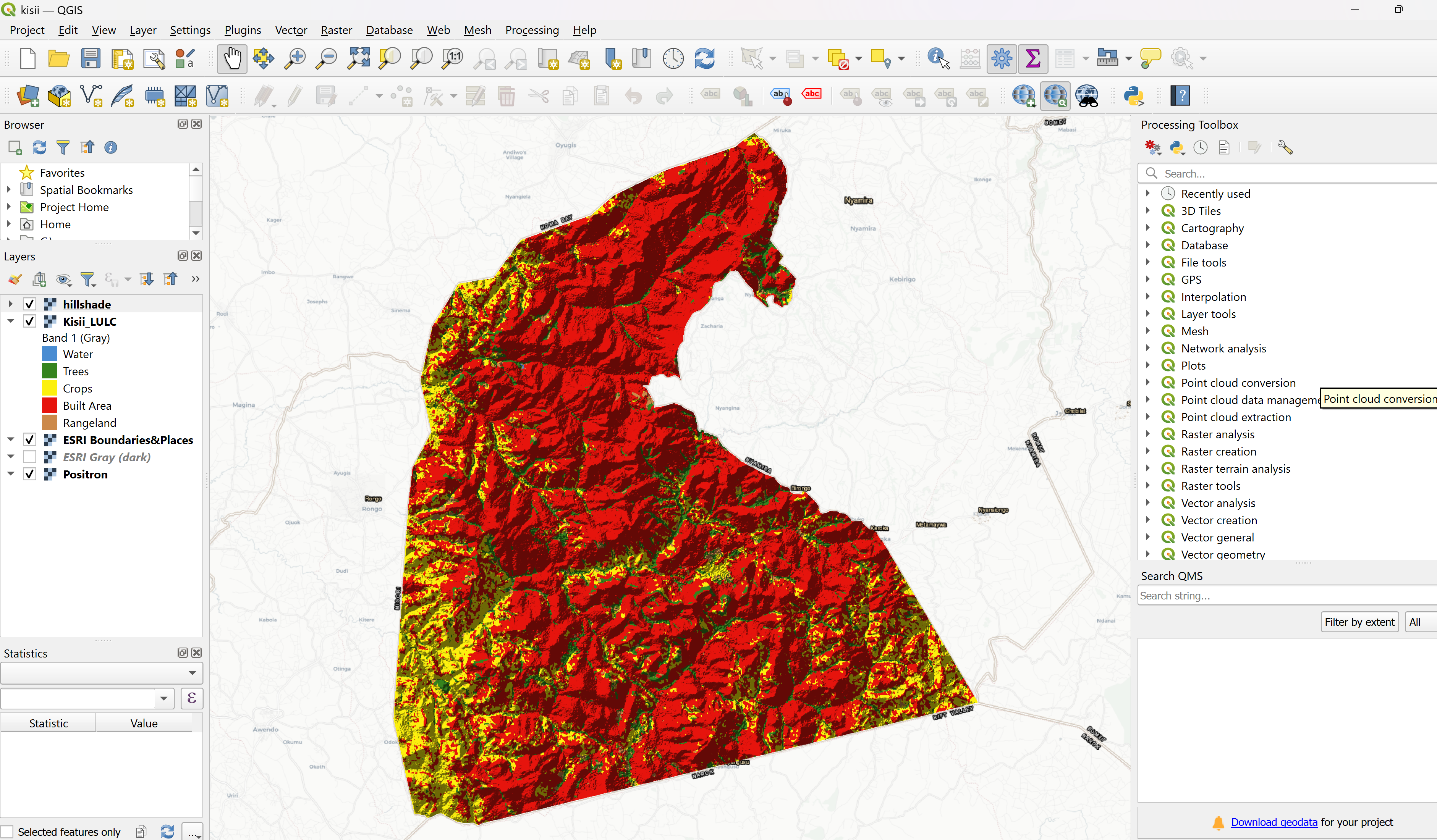
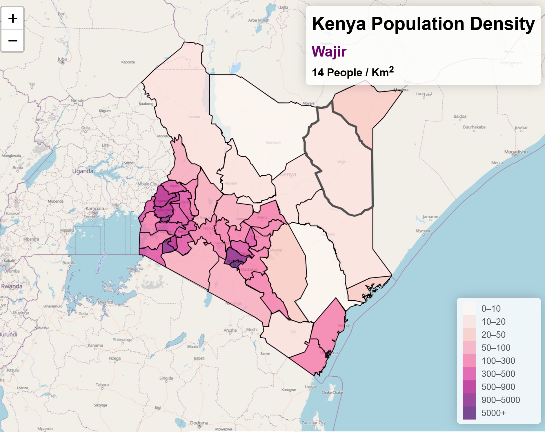
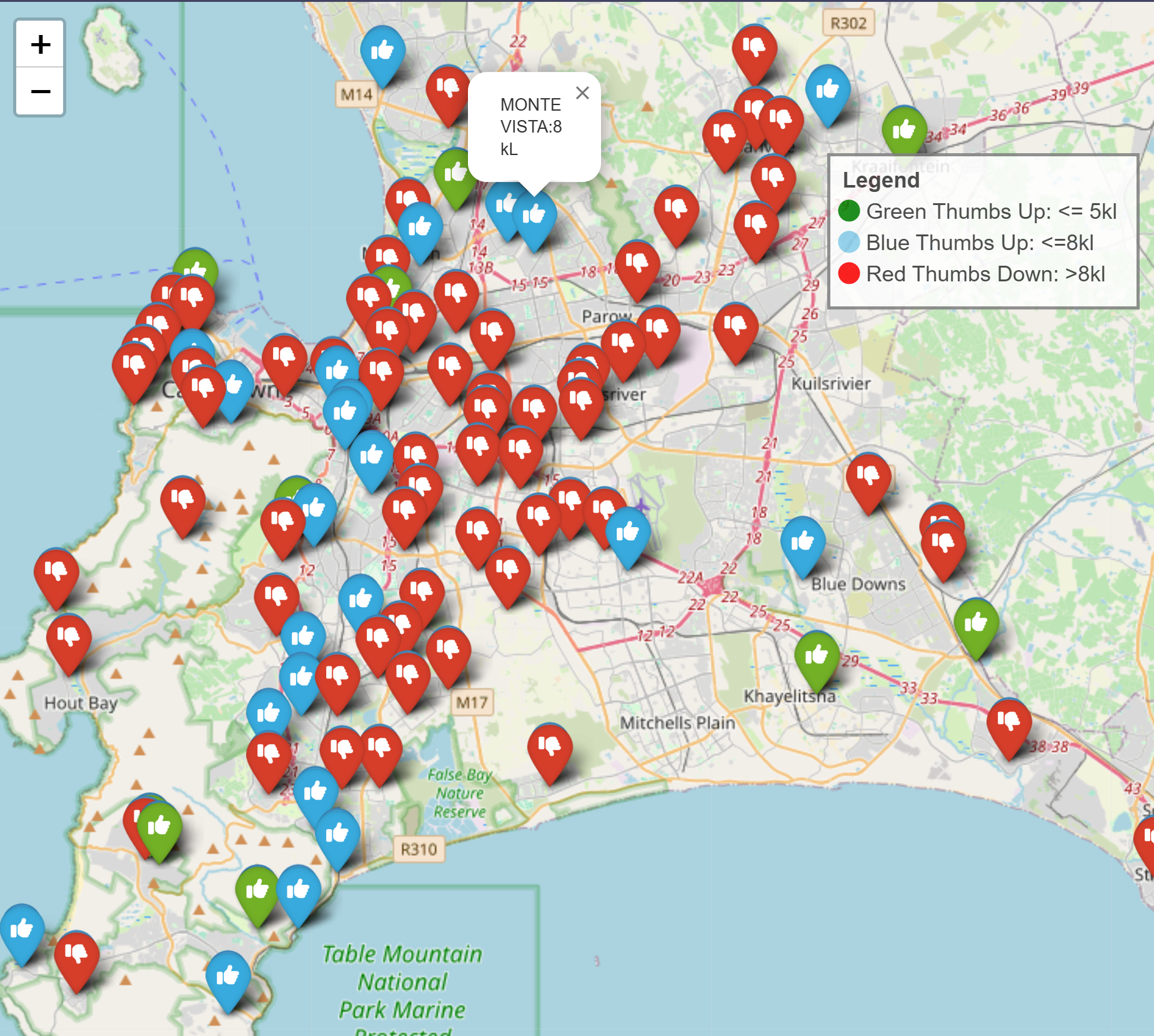


Check out my current projects and research in GIS, Remote Sensing, GeoAI, etc...
More ResearchABOUT ME

GIS & Remote Sensing Scientist
My name is Theresa Nyatichi Monari. I am passionate about leveraging GIScience, Remote Sensing, and GeoAI to drive environmental sustainability.
My research focuses on harnessing the power of GIS, remote sensing, and AI for disaster response and management, aiming to create innovative solutions that enhance resilience and support affected communities. I enjoy creating maps and all things about Geography for environmental sustainability and leveraging technology and geospatial data to better comprehend our planet earth!
"Mapping the world, one data point at a time for sustainability." 🌍